

How GPS Knows Exactly Where You Are?
Your phone doesn't “see” where you are. It measures time, calculates distance, and uses geometry to find you.
Open Google Maps, type a destination, and a blue dot appears almost instantly.
It feels almost magical.
But your phone doesn't actually know where it is.
It calculates where it is.
The Global Positioning System, or GPS, relies on a fascinating combination of satellites, extremely precise clocks, radio signals, and geometry.
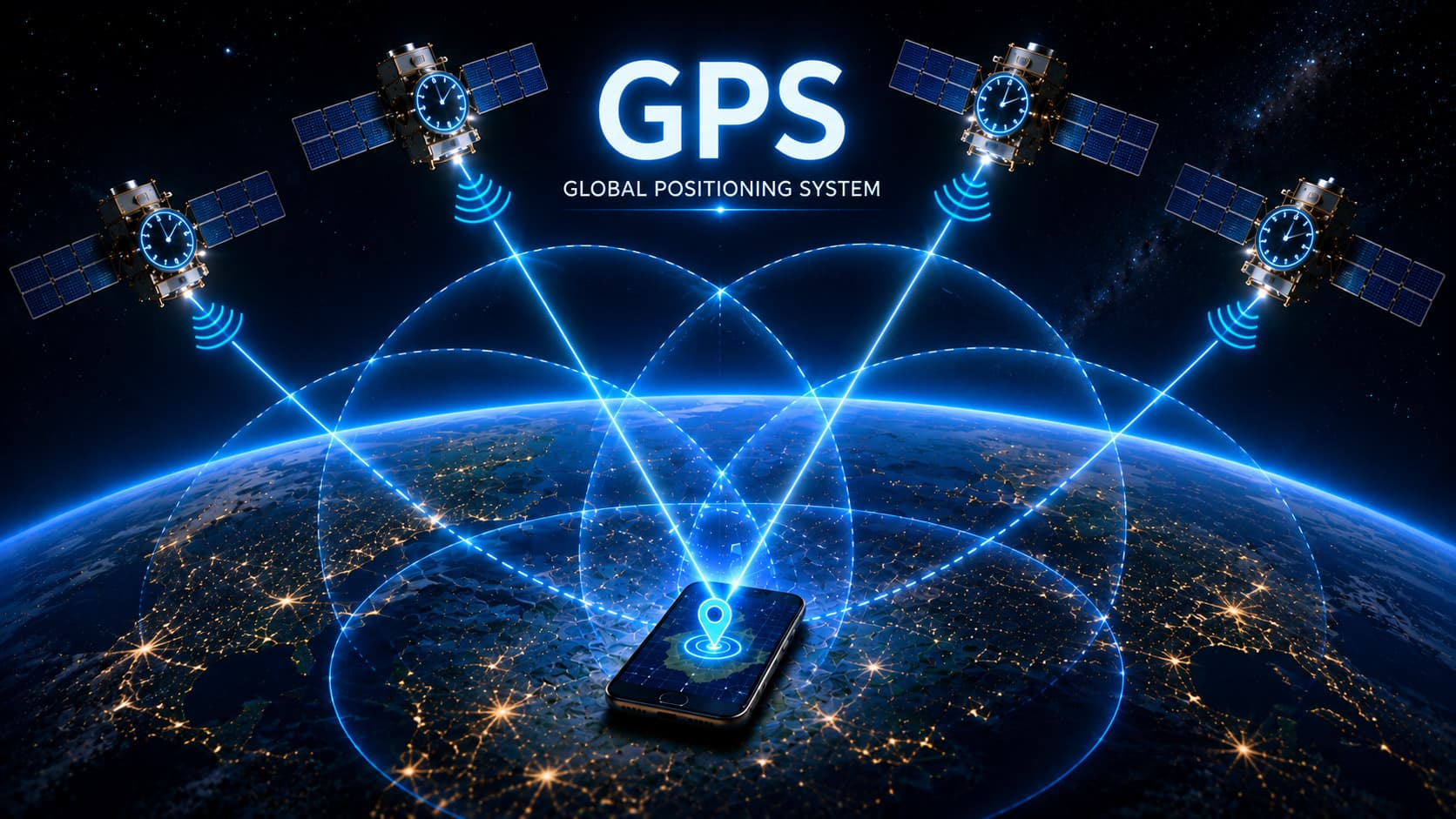
Satellites continuously broadcast signals containing information about where they are and what time it is. Your phone receives those signals and measures how long they took to arrive.
Because radio signals travel at nearly the speed of light, that tiny difference in time tells your phone approximately how far away each satellite is.
Do that with several satellites at once, and the possible locations begin to overlap.
Eventually, there is only one place where the measurements make sense.
That's where your phone is.
And the really surprising part?
GPS is fundamentally as much about time as it is about location.
Your Phone Doesn't Ask a Satellite, "Where Am I?"
Imagine you're standing somewhere on Earth and there are several satellites above you.
Each satellite is continuously broadcasting a radio signal.
Inside that signal is useful information, including:
-
The precise time the signal was sent
-
The satellite's position
-
Information about its orbit and movement
Your phone listens.
It knows when the signal was sent.
It knows when the signal arrived.
The difference between those two times tells it how long the signal travelled.
And from that, it can estimate distance.
The basic idea is beautifully simple:
Distance = Speed × Time
Since radio signals travel at nearly the speed of light, even a tiny difference in travel time can reveal a surprisingly large distance.
For example, a signal travelling for around 0.07 seconds would cover roughly 21,000 kilometers.
Your phone isn't measuring the distance with a ruler.
It's measuring time and turning that time into distance.
One Satellite Isn't Enough
Knowing that you're, say, 20,000 kilometers away from one satellite doesn't tell your phone exactly where you are.
It tells it that you're somewhere on an enormous sphere around that satellite.
Imagine drawing a giant invisible bubble around the satellite.
You could be anywhere on its surface.
Now add another satellite.
Your possible location becomes much narrower.
Add a third, and the possibilities shrink further.
This is where the geometry gets interesting.
Your phone effectively looks for the point where the measured distances from multiple satellites intersect.
This process is called trilateration.
And yes, there's an important distinction here.
People often say GPS uses triangulation.
Technically, that's not quite right.
Triangulation uses angles. GPS primarily uses distances.
So GPS is more accurately described as a trilateration system.
Did You Know?
With enough satellite measurements, GPS can calculate your position in three dimensions:
Latitude + Longitude + Altitude
But there's another problem hiding underneath all of this.
And it has nothing to do with geography.
It has to do with time.
Why Your Phone Needs Four Satellites
GPS satellites carry incredibly precise atomic clocks.
Your phone doesn't.
Your smartphone has a very good clock for everyday use, but it isn't accurate enough for the extreme timing precision required by GPS.
And here's why that matters.
Radio signals travel at around 300,000 kilometers per second.
That means a timing error of just one microsecond, one millionth of a second, can translate into roughly 300 meters of distance error.
That's enormous when you're trying to locate yourself accurately.
So GPS has a clever solution.
The receiver uses a fourth satellite.
The additional measurement allows it to solve not only for its location, but also for the error in its own clock.
So those four satellites are effectively helping your phone answer four questions:
Where am I in 3D space?
And:
What is the timing error in my clock?
This is one of the most elegant parts of GPS.
Your phone doesn't need an atomic clock.
It can mathematically correct for the fact that its clock isn't perfect.
The Atomic Clocks Behind Your Blue Dot
This is where GPS becomes much more impressive than the little blue dot on your screen suggests.
The satellites carry extremely precise atomic clocks.
Those clocks are carefully synchronized and continuously monitored.
Why go to such extraordinary lengths?
Because GPS is fundamentally a timing system.
If the satellite says:
"I sent this signal at exactly this time."
and your phone says:
"I received it at this time."
then the difference between those two moments becomes a measurement of distance.
Get the time wrong, and the distance is wrong.
Get the distance wrong, and your location is wrong.
So behind your navigation app is an elaborate global system of precision timekeeping.
In a strange way, your phone finds you by asking:
"How long did it take this signal to get here?"
Why Are the Satellites So Far Away?
GPS satellites orbit Earth in medium Earth orbit, far above the planet's surface.
Their altitude and distribution are important because GPS needs multiple satellites to be visible from almost anywhere on Earth.
The satellites are constantly moving.
So your phone can't simply assume that a satellite is permanently above a particular point.
Ground control systems continuously monitor the satellites, tracking their orbits and checking their health.
That information is used to keep the orbital data and timing information transmitted by the satellites accurate.
It's not just a collection of satellites floating above us.
It's a global infrastructure system involving space, ground stations, clocks, radio signals, and software.
Why GPS Sometimes Gets Your Location Wrong
GPS is incredibly useful.
But it's not magic and it isn't perfect.
You may have experienced this yourself.
You're standing between tall buildings, and your blue dot suddenly jumps to the wrong street.
Or you're inside a building and your location barely moves.
Several things can interfere with GPS accuracy.
Buildings Can Reflect Signals
Radio signals can bounce off buildings before reaching your phone.
Instead of taking the shortest route, a signal may arrive after reflecting off a nearby structure.
Your phone can interpret that longer journey as extra distance.
The Atmosphere Can Affect Signals
GPS signals travel through Earth's atmosphere, and the signal can be affected as it passes through different layers.
These effects can introduce small errors in the timing measurement.
Satellite Orbits Aren't Perfect
The satellites are constantly moving, and their predicted positions need to be continuously monitored and corrected.
You May Not See Enough Satellites Clearly
Dense cities, mountains, trees, and indoor environments can block or weaken signals.
The geometry of the available satellites also matters.
So the blue dot on your phone isn't always a perfect pinpoint.
It's the best estimate the system can calculate from the information available at that moment.
GPS Isn't the Only System Doing This
There's another interesting detail.
When we say "GPS," we're often talking about satellite navigation in general.
GPS is actually the navigation system operated by the United States.
Other countries and regions operate their own satellite navigation systems.
These include:
GLONASS — Russia
Galileo — European Union
BeiDou — China
Together, these systems are commonly described as GNSS — Global Navigation Satellite Systems.
Modern smartphones can use signals from multiple satellite constellations.
That means your phone isn't necessarily relying on GPS alone.
More available satellites can improve the chances of getting a reliable position, particularly in difficult environments.
Your Blue Dot Is Supported by a Huge Infrastructure
There's one final part of the story that is easy to overlook.
GPS satellites don't maintain themselves.
Ground stations around the world continuously monitor them.
They track:
-
Orbital position
-
Clock accuracy
-
Satellite health
-
Signal performance
Corrections are sent back to the satellites to keep their information aligned with reality.
So when your phone shows your location, you're not simply connecting to a satellite.
You're benefiting from a constantly maintained system that combines:
Space + atomic clocks + radio signals + ground stations + mathematics + software
All of that happens in seconds.
And you simply see a blue dot.
Where GPS Shows Up in Everyday Life
The technology has become so ordinary that we rarely stop to think about how much depends on it.
GPS helps power:
-
Turn-by-turn navigation
-
Ride-hailing
-
Food and package delivery
-
Fleet management
-
Emergency services
-
Fitness trackers
-
Aviation
-
Maritime navigation
-
Surveying and mapping
The remarkable thing isn't simply that GPS can tell you where you are.
It's that it can do it repeatedly, globally, and almost invisibly.
Knowlegic Perspective
GPS is a perfect example of technology that feels like magic because we don't see the machinery behind it.
You look at your phone.
A blue dot appears.
It feels like the phone somehow knows exactly where you are.
But underneath that simple interface is a much more beautiful explanation.
Satellites send signals.
Your phone measures their arrival times.
Those times become distances.
Those distances become intersecting spheres.
The geometry produces a location.
And incredibly precise clocks make the whole process possible.
GPS doesn't know where you are.
It calculates where you must be.
And that small distinction is what makes the technology so fascinating.
The next time your navigation app calmly tells you to turn left in 300 meters, remember what is actually happening.
Somewhere far above Earth, satellites are broadcasting signals.
Your phone is listening.
It measures tiny differences in time, converts them into distances, compares those distances across multiple satellites, corrects for clock error, and solves a geometric puzzle all in seconds.
What looks like a simple blue dot is actually the result of precision timekeeping, orbital mechanics, radio communication, and mathematics working together.
GPS doesn't have a magical sense of location.
It has something arguably more impressive:
A remarkably precise sense of time.
And from time, it can figure out where you are.
Enjoyed this?
Get notified when a new Knowlegic story worth knowing is published.


